
Success Story: Building a GIS Web Application for Easy Access to Geodetic Control Station Data
Background
Government agencies, surveyors, and engineering firms often rely on accurate geodetic control station (大地测量控制站) data for mapping, construction, and land development projects. However, accessing this information was traditionally difficult, requiring manual downloads, offline data checks, or specialized GIS software.
Our client wanted a solution that would make it easy for end-users to search, visualize, and use GIS data in an intuitive and accessible web environment—without needing advanced GIS training.
Challenges
- Complex Access: Existing data was scattered across different archives and required technical expertise.
- Slow Search: Users had difficulty locating specific control stations by name, ID, or geographic area.
- Limited Usability: No mobile-friendly interface, making on-site field usage inconvenient for surveyors.
- Integration Gaps: Data couldn’t easily connect with modern GIS systems for further analysis.
Our Solution
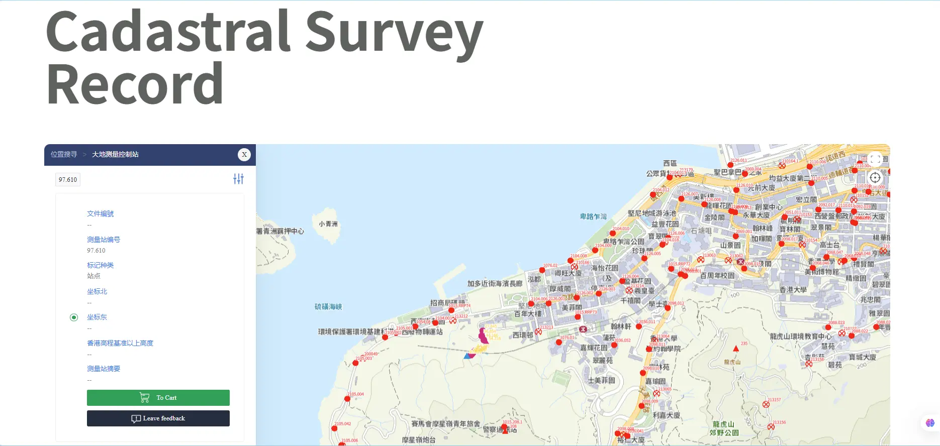
We developed a custom GIS-enabled web platform that allows users to quickly find and interact with digital map information.
Key features include:
- Advanced Search & Filters: Search control stations by coordinates, name, ID, or region.
- Interactive Digital Map: Dynamic web map (Leaflet / OpenLayers / Mapbox) with zoom, layers, and satellite overlay.
- Geodetic Control Station Information: View details such as coordinates, elevation, survey accuracy, and maintenance status.
- Responsive Design: Works seamlessly on desktop, tablet, and mobile devices so engineers can use it in the field.
- Export & Integration: Users can download data in standard GIS formats (Shapefile, GeoJSON, KML) or connect with third-party GIS systems.
- User-Friendly Interface: Simplified UX so even non-GIS professionals can search and etrieve data in seconds.